

.png)
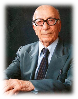
Previous Directors and their Activities
Nasser Saf Asfi (195-1961)
- Approved the establishment law for the Geological Survey of Iran (GSI).
- Served as Chairman, with the assistance of Engineer Nasrollah Khadem.
- Facilitated GSI’s membership in the International Union of Geological Sciences (IUGS).
- Secured a six-year plan under the United Nations (UN) for scientific collaboration in executive and developmental programs.
- Played a role in the establishment of the Ministry of Industries and Mines.
- Conducted a study of the Shakourabad iron mine in Zanjan, marking the first applied research project at GSI.
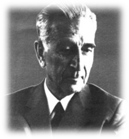 Nasrollah Khadem (1962-1973)
- Oversaw the integration of the Ministry of Trade with the Ministry of Industries and Mines, forming the Ministry of Economy.
- Initiated technical and expert collaborations between the United Nations and GSI, launching the first phase of cooperative plans with Johan Stocklin.
- Began thematic geological mapping at a 1:100,000 scale (non-systematic).
- Launched systematic geological mapping at a 1:250,000 scale.
- Established and commenced the National Stratigraphy Committee, including representatives from the National Iranian Oil Company, Iran Petroleum Exploration and Extraction Company, and GSI.
- Introduced several geological formations.
- Conducted studies on Central Alborz in collaboration with the University of Milan (Italy) and the Federal Institute of Technology (Switzerland).
- Established the cartographic department, training scientific staff under the supervision of Swiss experts to prepare geological maps.
- Published the first geological report by GSI.
- Prepared the preliminary “Distribution Map of Iran Ore Deposits.”
- Initiated thematic exploration projects, including bauxite and refractory material exploration.
- Established the geophysics department.
- Sent experts to France, Germany, and England for advanced studies to familiarize them with modern research methods.
- Constructed the GSI headquarters near Mehrabad Airport, including a library, laboratory, and museum.
- Conducted detailed studies on phosphate-bearing layers in Yazd and published the first report on Iran's phosphate reserves.
- Published the first geological map at a 1:250,000 scale (Golpayegan sheet).
- Signed a technical cooperation agreement with the Institute of Geology, Radioactive, and Nuclear Materials in Belgrade, Yugoslavia.
- Began preparation of 23 geological sheets at a 1:100,000 scale.
- Published geological maps and reports at scales of 1:500,000 and 1:100,000.
- Conducted geological and mineral studies on Jajarm bauxite.
- Prepared the “Tectonic Map of Iran” and an updated “Distribution Map of Iran Ore Deposits” at a 1:2,500,000 scale.
- Launched systematic aeromagnetic surveys (excluding border regions) in collaboration with Air-O-Service (USA).
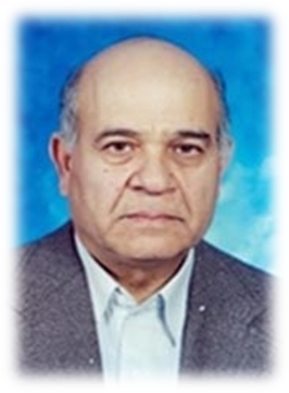
Reza Assefi (1974-1978)
- Discovered a perlite ore deposit with reserves of 50 million tons near Miyaneh.
- Initiated systematic geochemical mapping at a 1:100,000 scale.
- Continued regional geological studies in the Anarak and Baluchestan areas.
- Organized the “International Conference on the Geodynamic Project of Southwestern Asia.”
- Signed contracts for geological and mining studies in four eastern Iran blocks with companies from Australia, Canada, France, and the United States.
- Prepared the “Destructive Earthquakes of Iran Map” at a 1:5,000,000 scale.
- Approved the establishment of the Geological and Mineral Research Organization of Iran.
- Began central Iran geological mapping and prepared the “Seismotectonic Map of Iran” at a 1:2,500,000 scale.
- Collaborated on Southeast Asia geological maps, including tectonic and metamorphic maps.
- Introduced the Sungun porphyry ore deposit.
Ahmad Rahjoo (1979)
- Launched the alunite exploration project.
- Began geological mapping at a 1:100,000 scale in parts of central Iran as a regional initiative.
Azim Haghipour (198)
- Revoked the law establishing the Geological and Mineral Research Organization of Iran.
- Conducted detailed exploration of igneous phosphate in Esfordi, Bafgh
Mansour Alavi Naini (1981)
- Established the first regional center of GSI in Kerman.
- Started regional geological mapping in Makran at a 1:100,000 scale.
- Conducted exploration of Muteh Gold and Sangan iron ore deposits.
- Explored phosphate reserves of the Esfordi type in Bafgh.
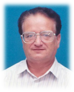
Reza Assefi (1974-1978)
- Exploration of perlite ore deposit with reserve of 50 million tons in the north of Miyaneh town
- Starting systematic geochemical mapping on 1:100,000 scale
- Continuing regional geological studies in Anarak and Baouchestan areas
- Holding “International Conference on Geodynamic Project of Southwestern Asia”
- Signing contract on geological and mining studies in four blocks of eastern Iran between four Iranian companies and Australia, Canada, France and United States
- Starting regional project of mapping on 1:100,000 scale in eastern Iran
- Preparing map entitled “Destructive Earthquakes of Iran” on 1:5,000,000 scale
- Approving law on establishing “Geological and Mineral Research Organization of Iran”
- Starting central Iran project
- Preparing “Seismotectonic Map of Iran” on scale 1:2,500,000
- Collaboration in preparing geological maps of southeast Asia (Geological, tectonic and metamorphic maps) in Iranian part
- Introducing Songon porphyry ore deposit for the first time by the GSI
- Geological and mineral mapping with cooperation of Techno-export Company in Anarak mining area
Ahmad Rahjoo (1979)
- Starting alunite exploration project
- Starting geological mapping on 1:100,000 scale in some parts of central Iran as a regional project
Azim Haghipour (198)
- Cancelling law on establishing “Geological and Mining Research Organization of Iran”
- Detailed exploration of igneous phosphate in Sfordi located in Bafgh area
Mansour Alavi Naini (1981)
- Establishing the first regional center of the Geological Survey of Iran in Kerman
- Starting regional project of mapping in Makran on scale 1:100,000
- Exploration of Muteh Gold and Sangan iron project
- Exploration of Esfordi type phosphate reserves in Bafgh area
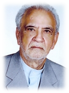
Mahmoud Ahmadzade Heravi (1989-1995)
- Launched systematic gold exploration and identified the Zarshouran Gold Mine.
- Began nepheline syenite exploration projects.
- Discovered magnesite deposits in southern Khorasan, transferring them to the private sector.
- Explored the Aghdareh gold deposit and transferred operations to the private sector.
- Established the GSI’s Northeast Regional Center (Mashhad).
- Founded the Research Institute for Earth Sciences.
- Published various thematic maps, including the “Magmatic Map of Iran” (1:1,000,000), “Tectonic Map of Iran” (1:1,000,000), and “Climatological Map of Iran” (1:2,000,000).
- Upgraded GSI laboratories with advanced analytical equipment.
- Identified promising mineral areas in the Shahr-e-Babak region using advanced data integration techniques.
- Discovered the first concealed porphyry copper deposit in Chah Firouz, Shahr-e-Babak.
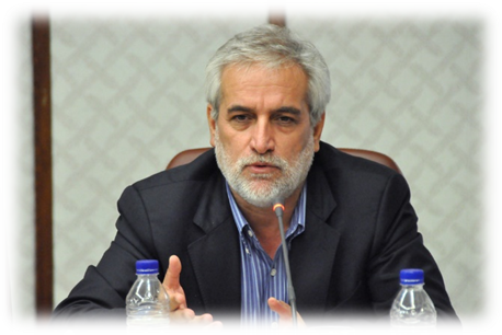
Mohammad Taghi Korehie (1997-2017)
-
Key Contributions and Initiatives
- Organizational Enhancements:
- Transferred all responsibilities and activities related to mineral exploration from the Ministry of Mines and Metals to the Geological Survey of Iran (GSI).
- Established critical organizational units, including:
- Marine Geology Department
- Environmental Geology Group
- Medical Geology Management
- Geomatics Management
- National Geosciences Database of Iran
- Supervision and Evaluation Department
- Created regional centers for GSI in Zahedan, Sari, Lorestan, Urmia, Isfahan, and Sanandaj.
- Integrated the Ministry of Industries with the Ministry of Mines and Metals, forming the Ministry of Industries and Mines, and later merging with the Ministry of Business to create the Ministry of Industry, Mine, and Trade.
- Exploration and Mapping Projects:
- Approved and executed systematic exploration projects for mineral reserves, including polymetallic minerals, igneous phosphate, rare earth elements, and gold.
- Conducted geological and geochemical mapping at scales of 1:100,000 and 1:25,000 in Sabzevar, Makran, and other regions.
- Pioneered advanced exploration projects using airborne geophysics and hyperspectral surveys, enhancing Iran’s geological database.
- Discovered and explored significant deposits, such as:
- Zarmehr and Zartorosht gold mines
- Kale Kaf copper and gold deposits (Esfahan)
- Iljagh potash (Zanjan)
- Sefiabeh antimony (Sistan and Baluchistan)
- Gandi gold (Semnan)
- Research and Technological Advancements:
- Established Iran’s first BLEG laboratory for gold analysis and the largest reference geosciences laboratory at the Applied Geological Research Center in Karaj.
- Introduced medical geology laboratories to investigate the impact of geological factors on human and environmental health.
- Modernized GSI's laboratories with state-of-the-art equipment, including an ICP-MS system.
- Acquired a B3 helicopter for airborne geophysical studies and established a dedicated flight and support center.
- Data Integration and Geoscientific Collaboration:
- Implemented projects integrating geological, geochemical, mining, satellite, and airborne geophysics data layers using GIS to identify mineral-rich zones.
- Published thematic maps, including:
- “Tectonic Lineaments Map of Iran” (1:5,000,000 scale)
- Geological, environmental, and economic geology maps (1:25,000 scale)
- “Metallogenic Map of the Middle East”
- Established geosciences databases for Iran and ECO Member States, facilitating regional and international cooperation.
- Marine Geology and Environmental Studies:
- Conducted marine geology cruises in the Persian Gulf, collecting sediment, water, and core samples to assess non-living resources.
- Initiated studies on geological hazards and environmental geology in various regions of Iran, including subsidence in the Varamin Plain.
- Collaborated on paleoseismological studies of major faults, including North Tehran, Taleghan, Firouzkuh, and Ray.
- Participated in the “Middle East Bases Evolution (MEBE)” project and prepared the “Middle East Quaternary Map” (1:5,000,000 scale).
- National and International Partnerships:
- Signed MoUs with countries such as Australia, France, Germany, China, and Nigeria, advancing technical collaboration in geology and mining.
- Collaborated with UNESCO and joined international organizations, including the International Medical Geology Association (IMGA).
- Provided geological expertise and exploration services to Latin America, Africa, and the Middle East.
- Educational and Knowledge Dissemination:
- Published the “Earth Science and Mining” monthly journal, gaining national and international recognition.
- Hosted the 32nd National and 1st International Geosciences Conference, attracting participation from over 36 countries.
- Partnered with universities to develop applied geological maps and facilitate advanced research.
- Significant Exploration Highlights:
- Defined and explored more than 20 high-potential mineral zones across 450,000 km² in Iran, using cutting-edge geophysical and geochemical techniques.
- Discovered and explored:
- Arghash, Sharafabad, and Naghdooz gold deposits (transferred to the private sector).
- Sefiabeh antimony, Khor and Biabanak potash (transferred to IMIDRO).
- Ahmadabad molybdenum and Gazestan rare earth elements (transferred to IMIDRO).
- Key Geological Projects and Studies:
- Published Iran’s first “Seismotectonic Map” and “Flood Hazard Map” (1:1,000,000 scale).
- Investigated Urmia Lake’s drying crisis, providing solutions for restoration.
- Studied the environmental impacts of economic exploitation of Urmia Lake’s salts.
- Conducted systematic studies on aerosols and prioritized key aerosol centers in Iran for mitigation.
- Legacy and Recognition:
- Registered Iran’s geological phenomena and natural heritage on UNESCO’s Global Heritage List.
- Enhanced international visibility through active membership in organizations like the International Quaternary Association.
- Established the “International Center for Medical Geology Research” and hosted Iran’s first “International Medical Geology Conference.”
Defining and Implementing Over 120 Exploration Projects Under the Combination Project Framework
- Mapping and Geochemical Studies
- Initiated the preparation of geochemical maps at a scale of 1:25,000.
- Began developing economic geology maps at a scale of 1:25,000.
- Exploration of Mineral Resources
- Conducted general and detailed exploration projects for gold deposits.
- Executed exploration projects in poly-metal promising areas.
- Investigated lead and zinc metallogenic belts in Iran.
- Explored igneous and sedimentary phosphate and bauxite reserves.
- Studied semi-precious rocks, industrial minerals, and construction materials.
- Applied ground geophysical methods to identify iodine-rich zones in Golestan Province.
- Conducted core drilling operations in gold and copper promising areas across Iran.
- Laboratory and Analytical Developments
- Established BLEG measurement laboratories in Karaj and Kerman centers to evaluate gold samples.
- Key Exploration Projects
- Reconnaissance and exploration of major deposits, including:
- Masjedaghi copper and gold (East Azerbaijan) transferred to the National Copper Company.
- Shadan and Khoopik gold and Mehrabad copper and gold (South Khorassan), transferred to the private sector.
- Chahpalang iron and manganese (Esfahan), Saheb iron (Kurdistan), and Chahekalb copper (private sector).
- Chah-e-Zaghoo copper, Kerver copper and gold (Kerman), and several iron deposits (Kurdistan).
- Launched the Makran Project, focusing on regional geological mapping and exploration.
- Infrastructure Enhancements
- Established a support and flight center for helicopter operations at the Applied Geological Research Center.
- Acquired a helicopter (B3) for airborne geophysical studies.
- Memberships and International Collaboration
- Joined the OneGeology Project to unify global geological maps in digital format (scale 1:1,000,000).
- Signed multiple MoUs, including agreements with Venezuela, China, and France for collaborative research and exploration.
- Geohazards and Environmental Studies
- Conducted paleo-ecology and paleo-climatology studies on Urmia Lake to assess the impact of climate change.
- Studied hazards linked to subsidence in Tehran's Varamin Plain and geological risks in mega-cities like Tehran, Karaj, and Mashhad.
- Geosciences Research and Publications
- Published thematic and geological maps, including:
- "Tectonic Lineaments Map of Iran" (scale 1:5,000,000).
- "Flood Hazard Map of Iran" and "Karstic Water Resource Potential Map" (scale 1:1,000,000).
- Specialized Centers and Groups
- Established:
- Environmental and engineering geology research groups.
- Hydrogeochemical and medical geology research units.
- Regional offices of the Geological Survey of Iran in Sanandaj, Lorestan, and Semnan.
- Notable Achievements
- Discovered and explored:
- Gold deposits (e.g., Torghabeh, Bardaskan, and Hired in Southern Khorassan).
- Rare Earth Elements and chromite reserves in Iran.
- Iodine zones in Golestan Province and nitrate deposits in Kohgiluyeh and Boyerahmad Province.
- Prepared the Mineral Distribution Map of Iran (scale 1:1,000,000) and conducted the Sangan Exploration Project.
- Held the First International Conference on Medical Geology and the 32nd National and 1st International Geosciences Conference with participation from 36 countries.
- Global Outreach and Heritage Preservation
- Registered geological phenomena and natural heritage sites in UNESCO’s Global Heritage List.
- Developed the Geosciences Database for ECO Member States.
- Initiated collaborative efforts with Tajikistan, Armenia, and Nigeria for geological research and capacity building.
- Ongoing Strategic Projects
- Launched systematic geochemical atlas projects, Rare Earth Element exploration, and preparation of geochemical and economic geology maps (scale 1:25,000).
- Developed strategies for mining investment and national resource management through collaboration with global entities.
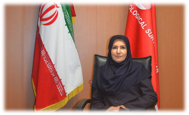
Dr. Razyeh Lak
-
Assistant Professor, Research Institute for Earth Sciences, Geological Survey of Iran (2011–Present)
Professional Roles and Responsibilities:
- Chief Scientist for projects on natural environment protection, focusing on air, soil, and water resources.
- Chairperson of the Iranian National Committee for IGCP, UNESCO National Office of Iran.
- Project Manager for Marine Geology in the Persian Gulf and Gulf of Oman.
- Manager of the Geological Segment of the Urmia Lake Restoration Project.
- Head of the Geological Committee for Urmia Lake Restoration.
- Scientific Secretary for the 32nd and 33rd National Geoscience Congresses, and the 1st and 2nd International Geoscience Congresses (Marine Geology and Oceanography Section, 2014; Lake Urmia Section, 2016).
- Reviewer and Scientific Committee Member for the ICOPMAS Conference (2010–2014).
- Reviewer and Committee Member of the Urmia Lake Rescue Conference (2014).
- Scientific Secretary for the National Conferences on Climate Change (2011) and Aerosols.
- Founding Member of the Iranian Quaternary Association.
- Founding Member of the Sedimentology Association of Iran.
- Contributor to the development of the Middle East Quaternary Map (CGMW).
Education
Ph.D. in Sedimentology
- Geology Department, Faculty of Science, Tehran Teacher Training University (2007).
Publications
- Lak, R., Saeedi, S., & Vosoogh, A. (2015). Heavy metal distribution in fractioned river sediments: Case study of Shafaroud River, southwest of Caspian Sea. International Journal of Environmental Science and Development, 6(7), 530–534.
- Lak, R. (2014). Sea level changes of the northern part of the Persian Gulf. Procedia - Social and Behavioral Sciences, 120, 763–757.
- Bayati, M., Lak, R., Modaberi, S., Saeidi, S., & Azad, S. (2014). Environmental geochemistry of metals in surface sediments of the northwest Persian Gulf (Bushehr Province). Journal of Tethys, 2(1), 9–19.
- Nezhadafzali, K., Shayan, S., Lak, R., Yamani, M., & Ghoreshi, M. (2014). [Title missing]. Journal of Applied Environmental and Biological Sciences, 4(3), 246–252.
- Dehghan Chenari, A., & Lak, R. (2014). Impacts of heavy metals and petroleum pollution on carbonate sediments of the Persian Gulf. International Journal of Environmental Research, 8(2), 457–464.
- Behbahani, R., Hosseinyar, G.R., & Lak, R. (2015). Preservation factors of organic matter in bottom sediments of the northern Persian Gulf. Neues Jahrbuch für Geologie und Paläontologie - Abhandlungen.
- Mohammadi Parvaneh, M., Lak, R., & Fatemi, Khaksar. (2014). Reconstruction of Caspian Sea water level fluctuations during the Holocene: A study of ostracods in Amirkelaye wetland. International Journal of Current Life Sciences, 4(9), 5509–5605.
- Mohammadi Parvaneh, M., Lak, R., & Fatemi, Khaksar. (2014). Investigating alterations of Caspian Sea level fluctuations and their impact on ostracods of Boujagh pond. Advances in Environmental Biology.
- Mojtahedin, Hadavi, & Lak, R. (2015). Distribution of coccolithophores as paleoceanographic proxies: Insights from the Oman Sea monsoonal patterns. Geologica Carpathica, 66(1), 60–80.
- Mojtahedin, Hadavi, & Lak, R. (2013). Paleoenvironmental factors in the Strait of Hormuz during the Holocene. Journal of the Persian Gulf, 4(13).
- Rezaeian Langroudi, S., Lak, R., & Turkamani. (2013). Hydrogeochemical characteristics of Hoz-e-Soltan Lake, Qom, Iran. Journal of Tethys, 1(3), ISSN: 2345-2471.
- Pouresmaeil, A., Hadavi, F., & Lak, R. (2012). Calcareous nannofossils in Holocene sediments of the Persian Gulf. Journal of Persian Gulf, 3(8), 13–35.
- Ahrari Roudi, Moussavi-Harami, Lak, R., Mahboubi, & Motamed. (2012). Using ground-penetrating radar (GPR) and sediment cores as methods for interpreting sedimentary environments: The estuaries of northern west Oman Sea. Research Journal of Environmental and Earth Sciences, ISSN: 2041-0492, 500–510.
- Lak, R., Darvishi Khatouni, J., Mohammadi, A., & Langroudi, S. (2014). Climate change evidence from core sediments of saline lakes in Iran: Maharlou, Hoz-e-Soltan, and Urmia. Geosciences Journal (In Persian).
- Salehipure Milani, A., Mohammadi, A., Darvishi Khatouni, J., & Lak, R. (2012). Temporal modeling of Urmia Lake fluctuations. Journal of Science & Research, Islamic Azad University Campus (Tehran University Press).
- Lak, R., Darvishi Khatouni, J., & Mohammadi. (2012). Paleolimnology study and causes of sudden decrease in Urmia Lake water levels. Journal of Applicable Geology, Zahedan University, 4, 357–372.
- Berberian, M., & King, G.C.P. (1981). Towards a paleogeography and tectonic evolution of Iran. Canadian Journal of Earth Sciences, 18(2), 210–265.
- Amiri, V., Nakhaei, M., Lak, R., & Kholghi, M. (2015). Assessment of seasonal groundwater quality and potential saltwater intrusion: A case study in Urmia Lake coastal aquifer (NW Iran) using the groundwater quality (GQI) and Hydrochemical Facies Evolution Diagram (HFE-D). Stochastic Environmental Research and Risk Assessment.
- Amiri, V., Nakhaei, M., Lak, R., & Kholghi, M. (2016). Investigation of salinization and freshening processes in coastal groundwater resources of Urmia aquifer, NW Iran. Environmental Monitoring and Assessment, 188(233).
- Djamali, M., Beaulieu, J.L., Andrieu Ponel, V., Miller, N.F., Poonel, P., Lak, R., et al. (2008). Vegetation history of the SE section of the Zagros Mountains during the last 5 millennia: A pollen record from Maharlou Lake, Fars Province, Iran. Vegetation History and Archaeobotany. DOI: 10.1007/s00334-008-0178-2.
- Djamali, M., Andrieu Ponel, V., Beaulieu, J.L., Berberin, M., Guibal, F., Lahijani, H., Lak, R., et al. New palynological evidence for agricultural practices in ancient Iran (submitted).
- Hosseinyar, G.R., Behbahani, R., Chaychizadeh, S., Lak, R., & Chakeri, M. (2013). High-resolution seismic stratigraphy and current-induced bedforms in the Khuran Strait, south of Iran. Marine Geology, 29(6a), 51–62.
Research Contributions
- Paleolimnology: Investigated water level fluctuations and paleoclimate in Maharlou, Hoz-e-Soltan, and Urmia Lakes during the Holocene.
- Marine Geology: Explored sedimentary dynamics and geochemical properties of Persian Gulf regions.
- Hydrogeology: Studied groundwater salinization and its management in coastal aquifers near Urmia Lake.
- Geological Hazards: Researched seismic stratigraphy and sediment dynamics in the Khuran Strait, South of Iran.
Key International Collaborations
- Member of the CGMW Middle East Quaternary Map Project.
- Collaboration with UNESCO in geoscience-related IGCP initiatives.
- Joint research on vegetation and agricultural practices with international teams (e.g., Zagros Mountains studies).
CURRICULUM VITAE
Alireza Shahidi
Birthday 16/09/1968
Married, 2 Childs
PROFESSIONAL ADDRESS:
Geological Survey of Iran
DIPLOMAS:
- 1991 License in Geology
University of Esfahan
Esfahan-Iran
- 2002 MSc in Stratigraphy and Palaeontology
‘Stratigraphy and Tectonostratigraphy of the rock units in Birjand area with especial emphasis on Shushud sedimentary basins
Geosciences Research Institute
Geological Survey of Iran
Tehran-Iran
- 2008 PhD in Geology
‘Tectonic evolution in North of Iran (Alborz and Kopet-Dagh) since Mesozoic
University of Pierre and Marie Curie (Paris 6)
Paris-France
PROFESSIONNELLE EXPERIENCE:
Since 1992 Geologist in Geological Survey of Iran
92-97 Field geologists in Stratigraphy Group
97-02 Senior geologist in Stratigraphy Group
02-05 Head of Stratigraphy Group
05-08 Senior geologist in Stratigraphy Group
09- 10 Secretary General of Publication Evaluation Committee
10- 11 Head of Stratigraphy Group
12- 17 Director of regional Geology
18- 19 Deputy of Geology ….
2019 Deputy Minister & GSI Director General
2020 Deputy Minister & GSI Director General
PROFITIONALLE AFFLIATION:
- Active member of Geological Society of Iran
- Student member of Geological Society of America (1989-1991)
- Member of Iranian Mining Engineering Organization (2004- present)
LANGUAGE:
Persian, French, English
Book:
- Nazari, H., Shahidi, A., 2010. Tectonic of Iran ‘Alborz’, Geological Survey of Iran, P. 119
- Shahidi, A., Nazari, H., Ghaemi, F., 2013. Tectonic of Iran ‘Kopet-Dagh’, Geological Survey of Iran, P. 205
PUBLICATIONS:
-
Shahidi, A., Nazari, H. (1995). Geological map of Harsine (1/100,000), GSI.
-
Rafiia, R., Shahidi, A. (1997). Geological map of Karkasar (1/100,000), GSI.
-
Hamzehpour, B., Nazari, H., Shahidi, A. (1998). Geological map of Izard - khast (1/100,000), GSI.
-
Shahidi, A., Baharfirozi, K. (1999). Geological map of Roum (1/100,000), GSI.
-
Nazari, H., Salamati, R., Shahidi, A. (1999). Geological map of Sarbisheh (1/100,000), GSI.
-
Shahidi, A., Zamani Pedram, M. (1999). Geological map of Dehbid (1/100,000), GSI
-
Shahidi, A., Baharfirozi, K. (2000). Geological map of Jian (1/100,000), GSI.
-
Shahidi, A. (2000). Tectonostratigraphiy study in Dehbid area, SW of Iran, 31th. international Symposium of Geology, Brazil.
-
Shahidi, A., Baharfirozi, K. (2001). Geological map of Halab (1/100,000), GSI.
-
Fonudi, M., Sayareh, A., Shahidi, A. (2001). Geological map of Qojur (1/100,000), GSI.
-
Nazari, H., Shahidi, A. (2001). Tectonic study in sedimentary basin in eastern part of Iran. The 19th. Symposium on Geosciences, Tehran, Iran, GSI.
-
Nazari, H., Omrani, J., Shahidi, A. (2002), Geological map of Bandar-e-Anzali (1/100,000), GSI.
-
Shahidi, A., Jalali, A. (2003). Geological map of Sardasht (1/100,000), GSI.
-
Shahidi, A., Salamti, R. (2003). Stratigraphy and Tectonostratigraphy of the Shushud basin.The 21th symposium on Geoscinces, Tehran, Iran, GSI.
-
Barrier, E., Brunet, M.-F., Saidi, A., Shahidi, A. (2004). Tectonic Evolution of Alborz (Iran) since Mesozoic. GEO 2004, 6th middle East Geosciences Conference and Exhibition, Bahrein.
-
Shahidi, A. (2005). Tectonic evolution and Geodynamic of the Alborz and Kopet-Dagh (Iran), Scince Mesozoic, Doctorates days, 16-17 juin 2005, Mine University of Paris.
-
Shahidi, A., Barrier, E., Brunet, M.-F., Saidi, A., Muller, C., 2006. Tectonic evolution of Alborz since Mesozoic (Iran), MEBE colloquium, 4.-5.12.2006: 47-49; Milan, Italy.
-
Brunet, M.-F., Shahidi, A., Barrier, E., Muller, C., Saidi, A., (2006). Geodynamic evolution of northern Iran in Connection with the South Caspian Basin origin, contribution from subsidence analysis, MEBE colloquium, 4.-5.12.2006: 12-13; Milan, Italy.
-
Shahidi, A., Barrier, E., Brunet, M.-F., Saidi, A., Muller, C., (2007). Tectonic evolution of Alborz since Mesozoic (Iran), Geophysical Research Abstracts, Vol. 9, 11074, 2007, Vienne
-
Brunet M.-F., Shahidi, A., Barrier, E., Muller, C., Saïdi, A., (2007). Geodynamics of the South Caspian Basin southern margin now inverted in Alborz and Kopet Dagh (Northern Iran), Geophysical Research Abstracts, Vol. 9, 08080, 2007, Vienne
-
Shahidi, A., Barrier, E., Brunet, M.-F., Saidi, A., Muller, C., (2007). Late Triassic to Present Tectonic evolution of Northern Iran. International Symposium on Middle East Basins Evolution. December 4-5, 2007. Paris-France.
-
Brunet M.-F., Shahidi, A., Barrier, E., Muller, C., Saïdi, A., (2007). Subsidence evolution of Alborz and Kopet-Dagh (northern Iran): Inferences on the south Caspian basin opening. International Symposium on Middle East Basins Evolution. December 4-5, 2007. Paris-France.
-
Shahidi, A. (2008). Tectonic evolution in North of Iran (Alborz and Kopet-Dagh), since Mesozoic. Theses doctorate, Paris 6 University, 500 p.
-
Shahidi, A., Barrier, E., Brunet, M.-F., Saidi, A. (2009). Tectonic evolution (Late Triassic- Middle Eocene extension) in central Alborz, Iran. Especial issue, Geosciences, GSI, Iran.
-
Shahidi , A., Barrier , E., Brunet, M.-F.and Nazari, H. (2009). Norian-Bajocian (Shemshak Groupe) extension in Alborz (north of Iran). Geophysical Research Abstracts, Vol. 11, EGU2009-3653-4, 2009. EGU General Assembly 2009
-
Shahidi , A., Barrier , E., Brunet, M.-F.and Nazari, H. (2009). Tectonic evolution and late Triassic-Middle Eocene extension in Central Alborz, Iran. Geophysical Research Abstracts, Vol. 11, EGU2009-3653-2, 2009. EGU General Assembly 2009
-
Nazari, H., Ritz, J-F., Walker, R., Alimohammadian, H., Salamati, R., Shahidi, A., Patnaik, R.and Talebian, M. (2009). Chronology of last earthquake on Firouzkuh Fault using by C14. Geophysical Research Abstracts, Vol. 11, EGU2009-4906, 2009, EGU General Assembly 2009.
-
Jalali, A., Hosayni, H., Shahidi, A. (2009). Geological map of Shahrud (1/25,000), GSI.
-
Jalali, A., Hosayni, H., Shahidi, A. (2009). Geological map of Mand Abad (1/25,000), GSI.
-
Shahidi, A., Barrier, E., Brunet, M.-F., Saidi, A. (2010). Tectonic Evolution of the Shemshak Basin, Alborz: Using Paleostress and Tectonic Subsidence. Abstract, 27th Symposium on Geosciences and the 13th Symposium on Geological Socity of Iran. P. 37, 20-22 Feb 2010, Tehran, GSI, Iran.
-
Brunet M.-F., Shahidi, A., Barrier, E., Muller, C., 2010. South Caspian Basin opening from subsidence analysis in Northern Iran. AAPG European Region Annual Conference Exploration in the Black Sea and Caspian Regions 17-19 October 2010, Kiev, Ukraine, Search and Discovery Article 90109 (2010).
-
Nazari, H., Ritz, J.-F., Salamati, R., Shahidi, A., Habibi, H., Ghorashi, M., Karimi Bavandpur, A. (2010). Distinguishing between fault scarps and shorelines: the question of the nature of the Kahrizak, North Rey and South Rey features in the Tehran plain (Iran). Terra Nova, Vol 00, No. 0, 1–11
-
Shahidi, A., Nazari, H. (2011). Tectonostratigraphy map Eastern Iran (1/400,000), GSI.
-
Shekarifard, A., Baudin1, F., Seyed-Emami, K., Schnyder, J., Laggoun-Défarge, F., Riboulleau, A., Brunet, M-F., Shahidi A. (2011). Thermal maturity of the Upper Triassic-Middle Jurassic Shemshak Group (Alborz Range, Northern Iran) based on organic petrography, geochemistry and basin modelling: implications for source rock evaluation and petroleum exploration. Geological Magazine, doi:10.1017/S0016756811000161, page 1 of 20.
-
Nazari, H., Ritz, J.F., Walker, R., Salamat, R., Rizza, M., Ghassem, A.., Patnaik, R., Alimohammadian, H., Hollingsworth, J., Jalali, A., Shahidi, A. (2011), Palaeoseismic Evidence for a Medieval Earthquake of Magnitude ~ 7 in the Firouzkuh (Central Alborz) Region of Iran. 6th International Conference on Seismology and Earthquake Engineering (SEE-6) Monday, 16 May 2011. Oral presentation, IIEES, Tehran, IRAN.
-
Shahidi, A., Barrier, E., Brunet, M.-F., Saidi, A. (2011). Tectonic evolution of the Alborz in Mesozoic and Cenozoic. Scientific Quarterly Journal, Geosciences, GSI, Iran. Vol: 21, No. 81, Autumn 2011, P. 201-216
-
Javidi Namini, F., Shahidi, A., Nazari, H., Shekarifard, A. (2011), Evaluation of petroleum generation potential of the Shemshak Group in Alborz Basin in the range of the Carnien- early Bajocien: Using Paleostress and Tectonic Subsidence. 2th Symposium on Geosciences on Azad University of Ashtian. Oral presentation, 30-31 Juan 2011, Ashtian, Iran.
-
Shahidi, A., Barrier, E., Brunet, M.-F., Saidi, A. (2012). Palaeostress records in Karaj Formation, Southern Alborz, Iran: Extensional events in relationships with Neo-Thetyan subduction. Abstract, 30th Symposium on Geosciences. P.----, 20-22 Feb 2012, Tehran, GSI, Iran.
-
Nazari, H., Shahidi, A., (2012). Tectonic of Iran 'Alborz'. Geological Survey and Mineral Exploration of Iran, 112 pp.
-
Shahidi. A., (2013). The rotation of eastern sector of Alborz using paleostress data. Abstract, Geological conference on the Eastern Alborz. ِOral presentation, Feb. 28, 2013, Damghan, University of Damghan, Iran.
-
Shahidi, A., Nazari, H., Ghaemi, F., (2013). Tectonic of Iran 'Kopet-dagh'. Geological Survey and Mineral Exploration of Iran, P. 212
-
Alimohammadian, H., Hamidi, Z., Aslani, A., Shahidi, A., Cifelli, F., Mattei, M. (2013). A tectonic origin of magnetic fabric in the Shemshak Group from Alborz Mts. (northern Iran). Journal of Asian Earth Sciences 73 (2013) 419–428.
-
Mirzaei Souzani, M., Shahidi, A., Alizadeh Sevari, F. (2013). Extension analysis in Shemshak sedimentary basin, case study of Balladeh valley in central Alborz. Scientific Quarterly Journal, Geosciences, GSI, Iran.
-
Rezaei, F., Nazari, H., Rahmaniyan, S., Shahidi, A., (2013). Scientific Quarterly Journal, Geosciences, GSI, Iran.
-
Avagyan, A., Shahidi, A., Sosson, M., Sahakyan, L., Galoyan, Gh., Muller, C., Danelian, T.,
-
Firousi, Khalil, B., Mkrtchyan, M., Vardanyan, S., (2013). New insights on structure and
-
geodynamic of Khoy region (NW Iran). Darius Programme. Tbilisi workshop. July 24-25, Tbilisi, Georgia, Abstracts volume, pp.11-13.
-
Nazari, H., Ritz, J.-F, Walker, R.T., Salamati, R., Rizza, M., Patnaik, R., Hollingsworth, J., Alimohammadian, H., Jalali, A., Kaveh Firouz, A., Shahidi, A., (2014). Palaeoseismic evidence for a medieval earthquake, and preliminary estimate of late Pleistocene slip-rate, on the Firouzkuh strike-slip fault in the Central Alborz region of Iran. Journal of Asian Earth Sciences 82 (2014) 124–135.
-
Avagyan, A., Shahidi, A., Sosson, M., Sahakyan, L., Galoyan, Gh., Muller, C., Danelian, T.,
-
Bahar Firousi, K., Bosch, D., Mkrtchyan, M., Shokri, M., Vardanyan, S., (2014). New Data on the Tectonic Evolution of Khoy Region (NW Iran). Darius Programme, Poster Session, December 08-09, Paris, France, Abstracts volume, pp.26-27.
-
Shahidi, A., Jalali, A., Shomali, sh., (2015). Geological map of Bushehr (radial ring 100 Km.), (1/50,000), GSI.
-
Shahidi, A., Shomali, Sh., Haghnazar, M., (2015). Geological map of Maranjab (1/100,000), GSI.
-
Avagyan, A., Shahidi, A., Sosson, M., Sahakyan, L., Galoyan, G., Muller, C., Vardanyan, S., Bahar Firouzi, K., Bosch, D., Danelian, T., Asatryan, G., Mkrtchyan, M. and Shokri, M., 2016. New data on the tectonic evolution of the Khoy region, NW Iran. Geological Society, London, Special Publications, 428, first published on April 7, 2016, doi:10.1144/SP428.13
Last updated date: Aug 25 2025